Satellite Imagery Reveals the Impact of Heavy Rainfall on the Antalya–Konya Highway
March 03
Following the heavy rainfall that affected the northern parts of Antalya in February 2026, flooding and transportation disruptions on the Antalya–Konya highway were identified through satellite imagery analysis conducted by the Antalya Bilim University GIS and Remote Sensing Laboratory.
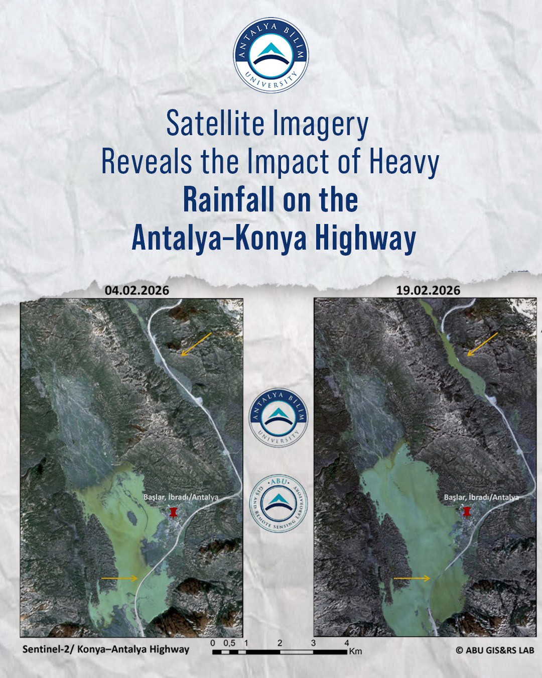
In the study carried out by the Antalya Bilim University GIS and Remote Sensing Laboratory, Sentinel-2 satellite images from the European Space Agency (ESA) were utilized. To enable a comparison between pre- and post-event conditions, two different dates were analyzed. While the Sentinel-2 image dated February 4, 2026, represented normal conditions, the image dated February 19, 2026, revealed a significant increase in surface water along the highway corridor, particularly in the Başlar/İbradı area and the upper watershed sections. Additionally, water accumulations were detected along certain segments of the roadway.
The findings demonstrate that the increase in surface water following the heavy rainfall occurred within the same spatial areas as the highway route. These results confirm that the transportation disruption experienced in the region can be scientifically verified through comparative analysis of satellite data.
Asst. Prof. Dr. Raziye Hale TOPALOĞLU, Head of the Antalya Bilim University GIS and Remote Sensing Laboratory, stated that spatial analyses conducted through the integration of Remote Sensing and GIS provide rapid and objective data in post-disaster assessments, thereby making significant contributions to decision-support processes. TOPALOĞLU also emphasized that comparing satellite data from different dates helps to more clearly understand the spatial impacts of such events.
Antalya Bilim University highlighted that data-driven analyses of this kind serve as a complementary information source for institutions and relevant stakeholders in disaster and emergency assessment processes.